
Geospatial Coordinates: Exploring Earth’s Positioning System
🌍 Understanding Geospatial Coordinates
Geospatial coordinates help define locations on Earth, just like how coordinates pinpoint a pixel on a screen or stitches in cross-stitching. Each point is represented by a pair of coordinates. For example, the Microsoft Campus in Redmond, Washington, USA, is located at 47.6423109, -122.1390293.
🗺️ Latitude and Longitude: The Earth’s Address System
The Earth is a sphere, and locations are measured in degrees, much like a circle’s 360° geometry.
- Latitude measures how far north or south a point is.
- Longitude measures how far east or west a point is.
🔎 Quick Thought: Why 360 Degrees?
No one is entirely sure why circles have 360 degrees! Some theories suggest it comes from the ancient Babylonians, who used a base-60 numbering system. Can you think of other things that use 360 degrees? (Hint: Look at a clock! ⏰)
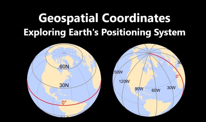
📍 Latitude: Measuring North & South
Latitude is measured using horizontal lines parallel to the equator:
- 0° → The Equator
- 90° North → The North Pole
- 90° South → The South Pole
- 45° North & South → Halfway points between the Equator and poles

🔹 Try this: Open Google Maps and find your city’s latitude. Is it closer to the Equator or the Poles? 🌏
🌍 Longitude: Measuring East & West
Longitude measures distances east or west of the Prime Meridian, the 0° reference line that passes through Greenwich, England.
- 0° (Prime Meridian) → Center reference for longitude
- -180° (West) to 180° (East) → The full range of longitude values
- Antimeridian (±180°) → The opposite side of the Earth from the Prime Meridian

💡 Did you know? The International Date Line follows the 180° meridian but zigzags to avoid splitting countries into different days.
🔹 Fun challenge: Find the longitude of a famous landmark, like the Eiffel Tower! 🗼
🎯 Degrees, Minutes, and Seconds vs. Decimal Degrees
Historically, latitude and longitude were measured using sexagesimal numbering (base-60), which is why we divide time into 60 minutes and 60 seconds.
- 1° (degree) = 60′ (minutes)
- 1′ (minute) = 60″ (seconds)
For example, at the Equator:
- 1° of latitude ≈ 111.3 km
- 1′ of latitude ≈ 1.855 km
- 1″ of latitude ≈ 0.031 km
📌 Example: The Eiffel Tower’s coordinates can be written as:
- Degrees, Minutes, Seconds: 48°51’29.6″N, 2°17’40.2″E
- Decimal Degrees: 48.85822, 2.29450
🔹 Try this: Convert your own location into decimal degrees using an online converter! 🔢
🚀 Explore & Engage!
✅ Find the latitude & longitude of your favorite place 🌎 ✅ Use Google Earth to check how coordinates change as you move 🔄 ✅ Try a GPS app to see your real-time location 📡
Geospatial coordinates are the foundation of navigation, maps, and even space exploration. Understanding them helps us explore the world more efficiently. Ready to map your next adventure? 🗺️✨
Read This: GPS Module Interfacing with NodeMCU ESP8266


